Semantic Segmentation of West Midtown and Hapeville
I chose two Atlanta neighborhoods experiencing growth and development in interesting ways as case studies for semantic segmentation. West Midtown is the extension of the burgeoning Midtown neighborhood, the cultural center of the Atlanta metro region, while Hapeville sits at a center point of the Aerotropolis region around Hartsfield-Jackson Airport.
2024-11-16
My theory was that West Midtown, with its proximity to Georgia Tech and recent high density development, is a more walkable neighborhood than Hapeville is, despite its location as an international entry point to the Atlanta metropolitan region. This is due to West Midtown’s density of recent housing projects, many of which cater to Tech students. Hapeville, on the other hand, historically hasn’t been a first stop for travelers to ATL’s airport, and I hypothesize that most tend to drive through it rather than spend time walking in it.
After choosing census tracts for both of these neighborhoods, I prepared Open Street map data, downloaded GSV images, and applied a computer vision technique (semantic segmentation) in Google Colab.
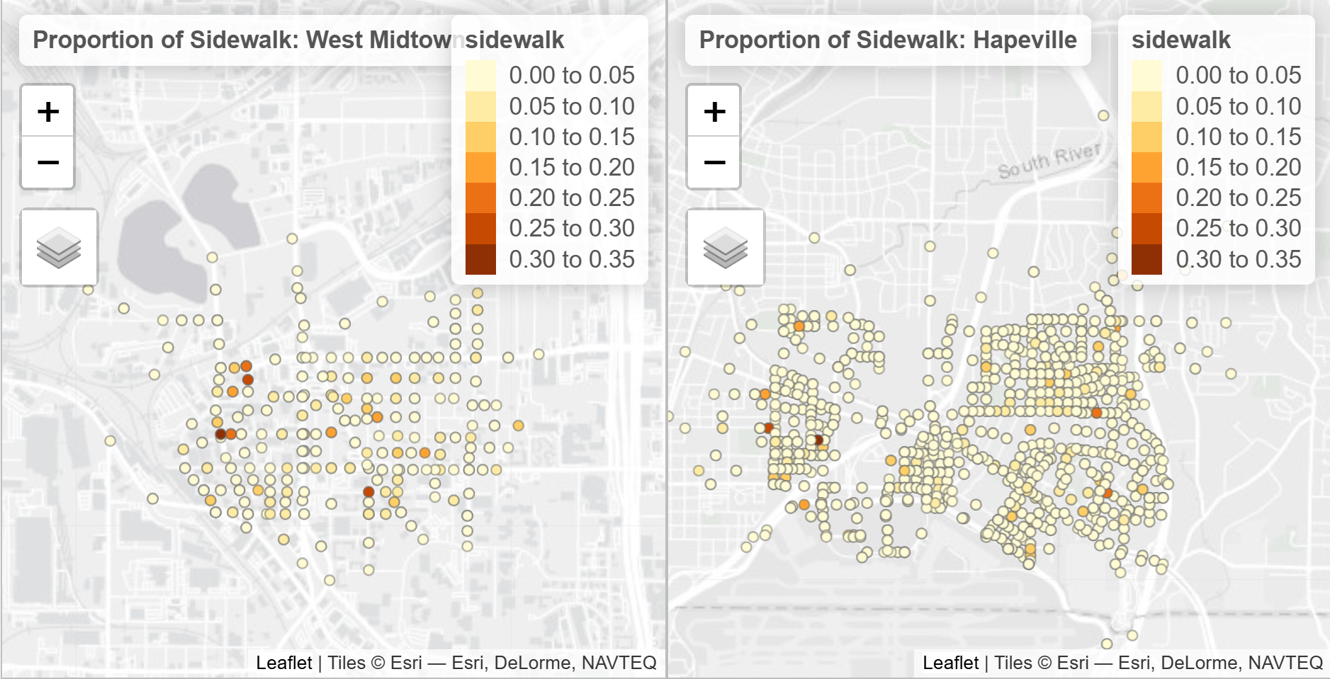
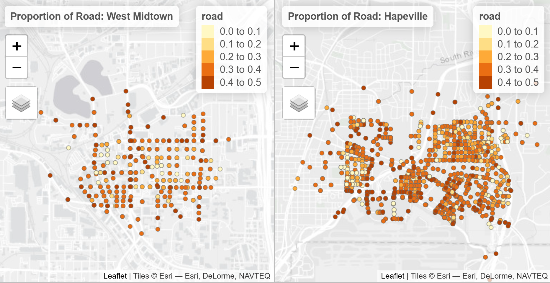
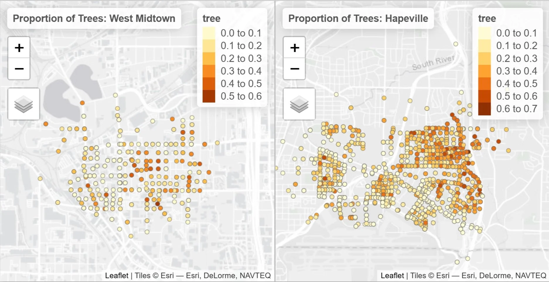
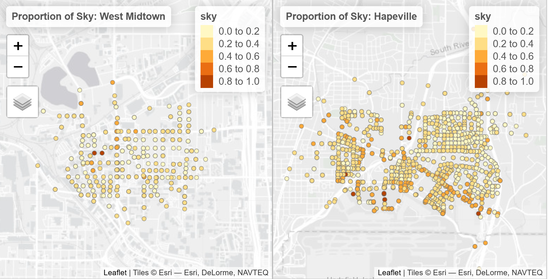
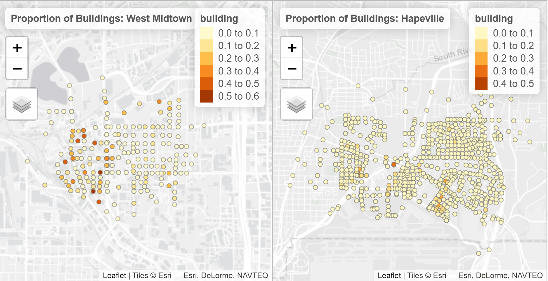
After applying computer vision to the images, the number of pixels in each image represented 150 categories in my data. I focused on on the following categories in my analysis: building, sky, tree, road, and sidewalk. I created interactive maps to visualize the spatial distribution of different objects, compared the mean of each category between the two Census Tracts and then drew boxplots to compare the distributions.